MapGO is a powerful geolocation tool that helps you identify administrative regions, calculate distances to borders, and find the nearest coastline—all with just a few clicks. Perfect for developers, travelers, and geography enthusiasts, MapGO simplifies complex geolocation tasks into an intuitive experience.
Key Features:
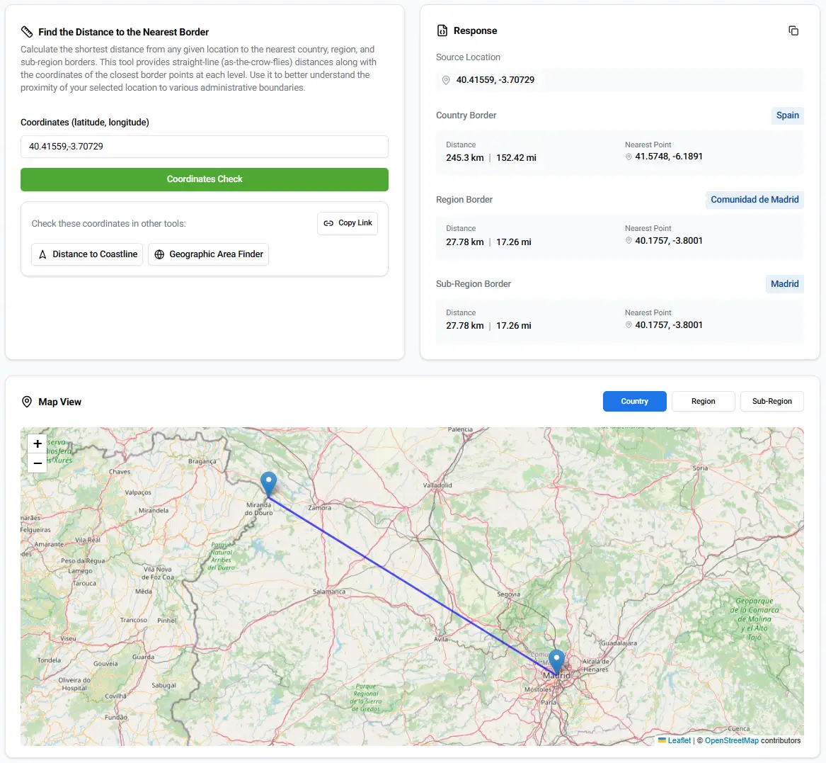
📍 Identify administrative regions for any location
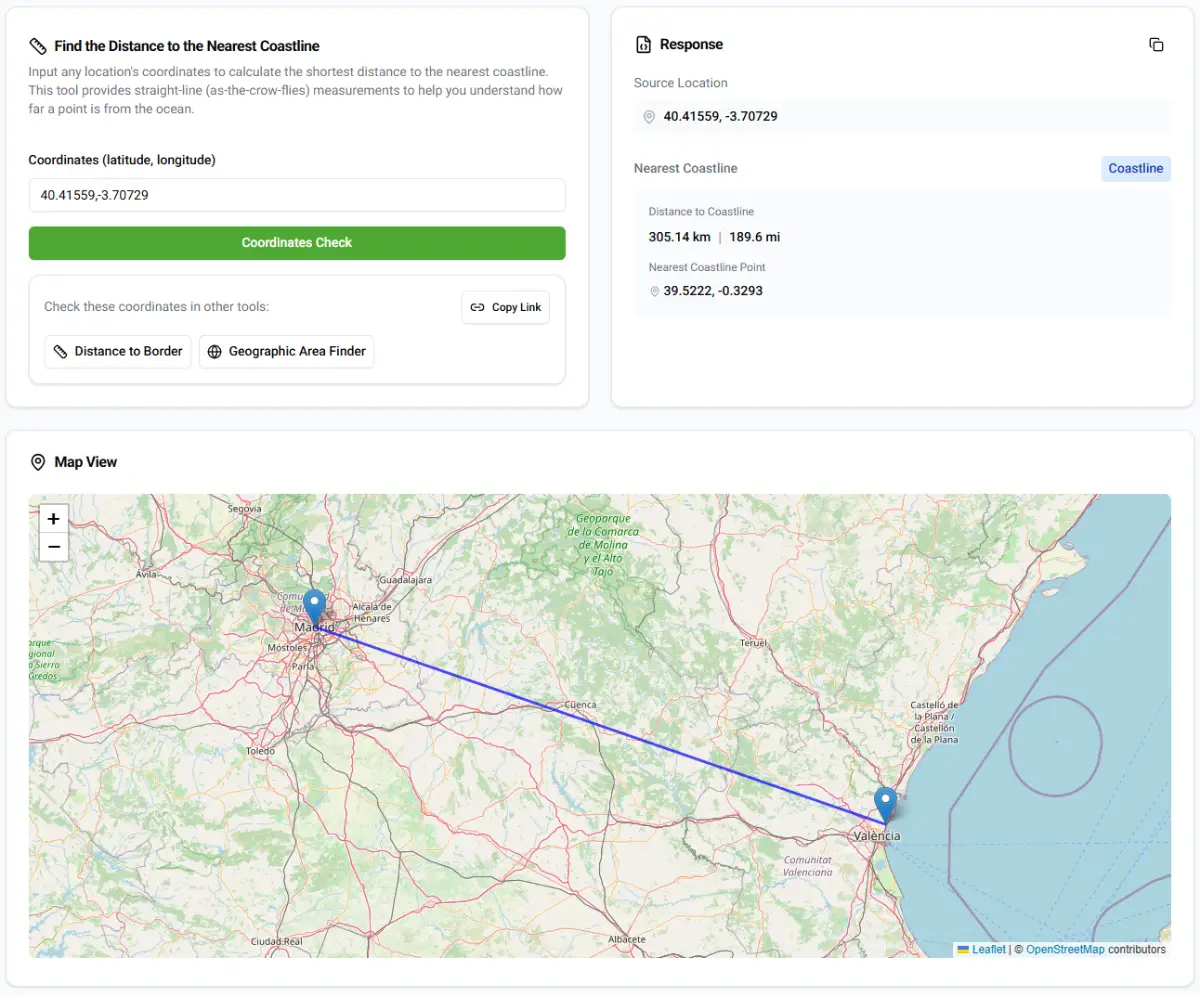
📏 Calculate distances to borders and coastlines
🌍 Straight-line (as-the-crow-flies) measurements
🗺️ Interactive map views for easy visualization
🚀 Fast, accurate, and user-friendly
Who is it for?
👩💻 Developers integrating geolocation features
🧳 Travelers planning routes and exploring new areas
🔬 Researchers analyzing geographic data
🌎 Anyone who loves exploring the world with precision
Start mapping today with MapGO!

About MapGO
MapGO is a development product listed on Uneed, with a free tier and paid plans. It's tagged with Development, API & Data. See the best Development products for related options.
Frequently asked questions about MapGO
What is MapGO?
MapGO is mapGO – Location Intelligence at Your Fingertips.
Is MapGO free?
MapGO offers a free tier with paid plans available for additional features.
What are alternatives to MapGO?
Discover similar development, api & data products in the Uneed directory.
What category does MapGO belong to?
MapGO is listed under Development on Uneed.
User comments
No one has posted a comment yet
Please login to leave a reviewThis product has no rewards yet.
This product has no deals yet.
Publisher
Launch Date
2025-01-28Category
DevelopmentPricing
FreemiumSocials
For Sale
No
Best products in the same categories
Upvoted by
Related tools
wavespeed ai
Access 1000+ AI models via unified API or web playground
Founder Lift
Founder Lift: Access $475K+ in exclusive startup perks, free software credits
test-proxy-recorder
VCR-style record & replay for Playwright testing
Tencent EdgeOne Makers
Ship AI agents like web apps, in minutes.
Appaloft
Open-source deployment control plane for shipping apps to your own servers.